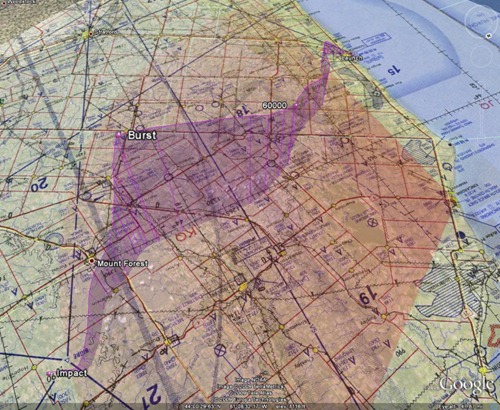
This is a screenshot of a 3D path of the simulated balloon trajectory had we launched the balloon today. The flight path is visualized with Google Earth and overlaid on the latest Nav Canada aeronautical chart.
In this simulation, we would be launching our payload near Goderich, ON. The payload would travel a lateral distance of 104 km and land a few kilometers north of Hopeville, ON. I’ve added the aeronautical chart to this view to ensure that we’re not crossing any major airways at altitudes that may interfere with commercial air traffic.
During the summer, we will compile a report every morning with a projected path such as the one seen above along with other important information such as local weather and cloud coverage (so we can get awesome pictures). If everything looks good, we’re off to the trucks for the launch!


#1 by Anson on June 13, 2009 - 11:39 am
This is cool.